A care institution can disappear before its last wall comes down.
A hospital may merge into another system. A clinic may move to a new address. A pharmacy may lose the customers, physicians, transit routes, and neighboring businesses that made the counter reachable. A church may survive as a building while the congregation relocates. A medical school may remain open while a freeway cuts through the commercial and residential district around it. Urban renewal and interstate construction could therefore dismantle Black care infrastructure without producing one simple closure date.
The word disappearance needs discipline. It can mean demolition, but it can also mean forced relocation, merger, route severance, patient and customer dispersal, loss of professional relationships, loss of archives, or the isolation of a surviving institution from the neighborhood system that once supported it. CultureUp should name the mechanism instead of allowing one dramatic word to replace the record.
A care institution was rarely only one building
A Black neighborhood care network could include hospitals, clinics, physicians, nurses, pharmacists, pharmacies, churches, mutual-aid rooms, funeral homes, medical schools, nursing schools, professional associations, transit lines, sidewalks, directories, newspapers, and trusted routines. The network could also include people whose work was less visible in the official record: clerks who knew how to reach a doctor, church members who organized rides, business owners who extended credit, nurses who connected families to services, and funeral professionals who carried records between institutions.
Urban renewal did not have to erase every node to weaken the network. Removing a commercial block could eliminate a pharmacy, medical office, lunch counter, insurance agency, and bus stop at once. A highway could leave a hospital physically standing but harder to approach from the neighborhood it once served. Relocation could produce a larger or newer facility while breaking pedestrian access, customer habits, informal referrals, or the visibility of Black professional authority on a familiar street.
The network frame also prevents nostalgia from becoming evidence. Black institutions could be underfunded, segregated, inaccessible to some residents, internally unequal, or unable to provide every needed service. Documenting their destruction does not require pretending they were perfect. It requires recognizing that an imperfect institution can still hold employment, training, care, dignity, records, and neighborhood continuity that a demolition total does not measure.
Urban renewal and the highway were related, but not identical
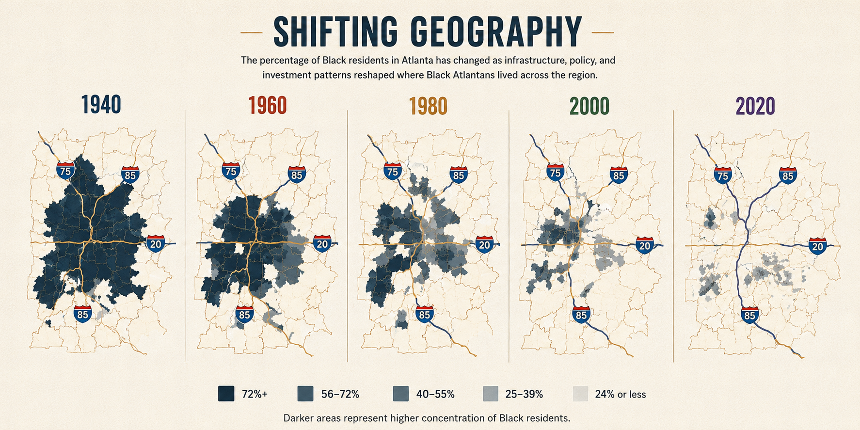
Federal urban renewal began under Title I of the Housing Act of 1949. Cities used acquisition, clearance, demolition, infrastructure change, and redevelopment to remake areas labeled blighted. Later interstate construction often overlapped with those plans, supplied another source of federal power and money, or placed limited-access roads through neighborhoods already targeted for clearance. The programs could reinforce each other, but the local legal instruments, timelines, agencies, parcels, and outcomes still have to be separated.
HUD’s own retrospective notes that demolition and displacement fell heavily on lower-income households and that Black-headed households were frequently among those displaced. The lesson for a health article is not that every renewal project had one hidden medical purpose. It is that housing policy, transportation policy, commercial geography, and health access can occupy the same map. When a renewal boundary encloses the places where people obtain medicine, training, food, worship, insurance, and social support, the health story cannot stop at the housing count.
Institutional disappearance card
| Outcome | Evidence to seek | What the term does not prove |
|---|---|---|
| Demolished | Parcel maps, condemnation records, photographs, permits, deeds, right-of-way plans | That services ended immediately, no successor existed, or every person experienced the loss identically |
| Relocated | Old and new addresses, deeds, permits, board minutes, directories, opening notices | That continuity was complete or that the old building was demolished |
| Merged | Board records, legal filings, annual reports, staffing and service transitions | That the institution was demolished or that all local authority and relationships survived |
| Closed | Licensing records, final notices, bankruptcy or dissolution files, newspapers | Why it closed, who lost access, or whether another provider replaced every function |
| Survived but isolated | Route maps, pedestrian barriers, business directories, land-use change, transit records | That the surrounding care network remained intact merely because the building stayed open |
Hayti shows why one closure story is not enough
Durham’s Hayti district was a Black residential, commercial, religious, and professional center. The City of Durham now states directly that the path of NC 147 destroyed established Black communities including Hayti and Brookstown, separated or demolished homes, businesses, and worship places, permanently displaced residents, and remains a barrier to access. Duke University Libraries preserves maps of the Hayti-Elizabeth Street renewal area and reports that Durham renewal destroyed more than 4,000 households and 500 businesses in predominantly Black areas.
Those totals describe a broad transformation. They do not tell the institutional story by themselves. To understand care, the researcher has to place hospitals, pharmacies, churches, medical offices, schools, funeral homes, transit lines, and residences on the map, then determine what happened to each one.
St. Joseph A.M.E. Church provides one trajectory. The National Park Service describes it as a Hayti anchor and records that interstate development and urban renewal devastated the district. The congregation relocated in the mid-1970s. The former church building survived and became the Hayti Heritage Center. The institution therefore did not simply vanish: congregation, building, location, and public-memory function followed different paths.
Lincoln Hospital followed another path. It had been a Black-led hospital, training institution, and site of public-health work. Lincoln Community Health Center began in the hospital basement in 1971. Lincoln and Watts hospitals merged in 1976, and the health center moved to its current site in 1982. Parking now occupies the old Lincoln Hospital site. The available record supports a merger, site loss, and a form of community-health-center continuity. It does not support the simpler statement that the Durham Freeway directly closed Lincoln Hospital.
Desegregation expanded access and changed relationships
A Black health-memory article must not confuse the loss of a Black institution with an argument for preserving segregation. Black patients and professionals fought for access to hospitals that had excluded them and for equal treatment inside better-resourced systems. Desegregation was a civil-rights gain.
At the same time, institutional integration could alter the professional authority, referral habits, employment routes, and social relationships centered on a Black hospital. Duke’s public-history materials describe both expanded access and losses associated with the transition from Lincoln. The responsible frame keeps both facts visible: access to formerly exclusionary institutions mattered, and the disappearance of a particular Black-controlled node could still weaken local continuity.
Jefferson Street held care, education, and business
North Nashville’s Jefferson Street offers a second network case. Tennessee State University’s public-history project describes North Nashville as a Black refuge and business district under Jim Crow, with churches, schools, entertainment, professional life, and commerce. USDOT records that I-40 divided the historically Black community and later became the subject of public reconnection work.
Care infrastructure was part of that corridor. Meharry Medical College trained physicians, nurses, dentists, and pharmacists and survives as a major Black medical-education anchor. Emma Stone completed Meharry’s pharmacy program in 1907 and operated Campus Drug Store at 1712 Jefferson Street. These records show why the health map includes both a major institution and smaller storefront nodes.
Meharry’s survival does not mean the surrounding network survived intact. A freeway can spare a campus while reducing walkable connections, removing homes and businesses, changing transit and customer flows, and weakening the commercial corridor through which students, patients, professionals, and residents moved. The distinction protects the article from claiming that Meharry disappeared while still allowing the surrounding damage to be documented.
Detroit requires the same timeline discipline
USDOT states that construction of I-375 cut through Black Bottom and Paradise Valley and displaced 130,000 people and hundreds of small businesses. The figure makes the scale of disruption visible, but it is not a list of every institution. Directories, deeds, professional licenses, hospital records, advertisements, newspapers, and maps are still needed to identify the care network block by block.
Dunbar Hospital is an important boundary against careless storytelling. The National Park Service records that Dunbar opened in 1917 as Detroit’s first hospital for Black residents and moved to a larger site in 1928. That move occurred decades before I-375. Dunbar belongs in the history of Black medical infrastructure, but the record does not permit CultureUp to say that the interstate demolished or closed it.
The selected Library of Congress image for this article also needs a firm limit. Arthur S. Siegel photographed an unnamed Black man walking in a Detroit business district in February 1942. The image documents Black urban presence before the I-375 era. The catalog does not identify the district as Black Bottom or Paradise Valley, show a care institution, name the person, or document later displacement.
Public health could be used to clear a neighborhood
The relationship between public health and urban renewal was not always protective. A peer-reviewed study of Southwest Washington documents how health rationales and public-health tools helped justify clearance. In that case, 99 percent of existing buildings were destroyed, 1,500 businesses and 23,000 residents were displaced, and most relocated families were nonwhite.
The lesson is not that public health had one role in every city. It is that words such as sanitation, safety, overcrowding, blight, and health could describe real conditions while also being used inside a political process that removed residents rather than supplying repairs, services, or ownership protections. CultureUp should therefore ask who defined the problem, what alternatives were considered, which institutions were counted, who controlled the land after clearance, and whether residents could return.
The lost network had social and psychological dimensions
The root-shock framework argues that dispossession can produce financial loss, loss of social organization, and psychological trauma. That interpretation helps explain why relocation payments or a replacement building may not restore the former network. The framework is not an individual diagnosis. People respond differently, and a community’s experience must not be reduced to one clinical label.
A 2025 study found urban highways associated with reduced short-distance social connectivity across major U.S. metropolitan areas. The study strengthens the idea that a highway can operate as a relationship barrier, but its limits matter: it uses platform-derived social-network data from 2012–2013, models association, and cannot prove historical causality or an individual health effect.
Together, these sources support a bounded statement: a care network depends on more than geographic proximity. It depends on repeated contact, short routes, social recognition, professional referrals, and institutional continuity. When renewal scatters people and separates streets, those connections may become more difficult to sustain.
How to reconstruct a disappeared care network
No single archive will contain the full network. Renewal maps may show structures and parcels but not every business function. Directories may list a physician or pharmacy but omit informal work and unlicensed support. Hospital annual reports may document beds and staff but not every community relationship. Oral history may preserve meaning that official files ignored, while still requiring consent, attribution, and corroboration.
Care-network reconstruction card
| Record type | What it may show | Primary caution |
|---|---|---|
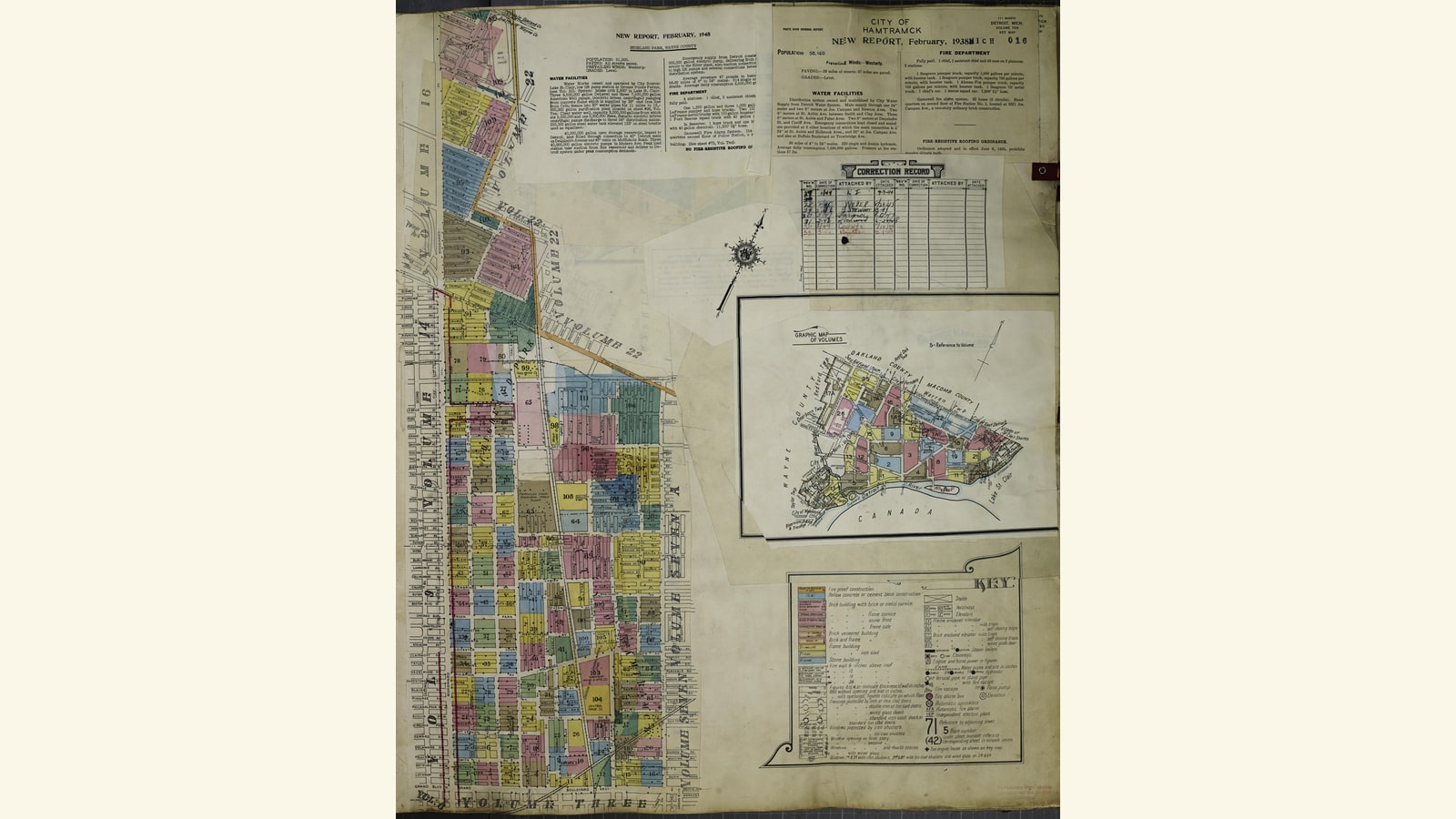
| Renewal map or right-of-way plan | Project boundary, parcels, structures, proposed demolition, new roads | A symbol or boundary does not establish ownership, service, or final outcome without the legend and later records |
| City directory or professional license | Name, occupation, business category, address, year | Listing does not prove ownership, quality, every service, or every year of operation |
| Hospital, clinic, church, or school record | Institutional timeline, leadership, programs, moves, mergers | Self-history may omit conflict, patient experience, or displaced relationships |
| Transit map and street record | Routes, stops, crossings, barriers, changes in access | A route on paper does not prove frequency, affordability, accessibility, or experienced travel time |
| Relocation summary or aggregate report | Numbers moved, compensation categories, destination patterns | Do not expose identifiable family files or infer individual medical outcomes |
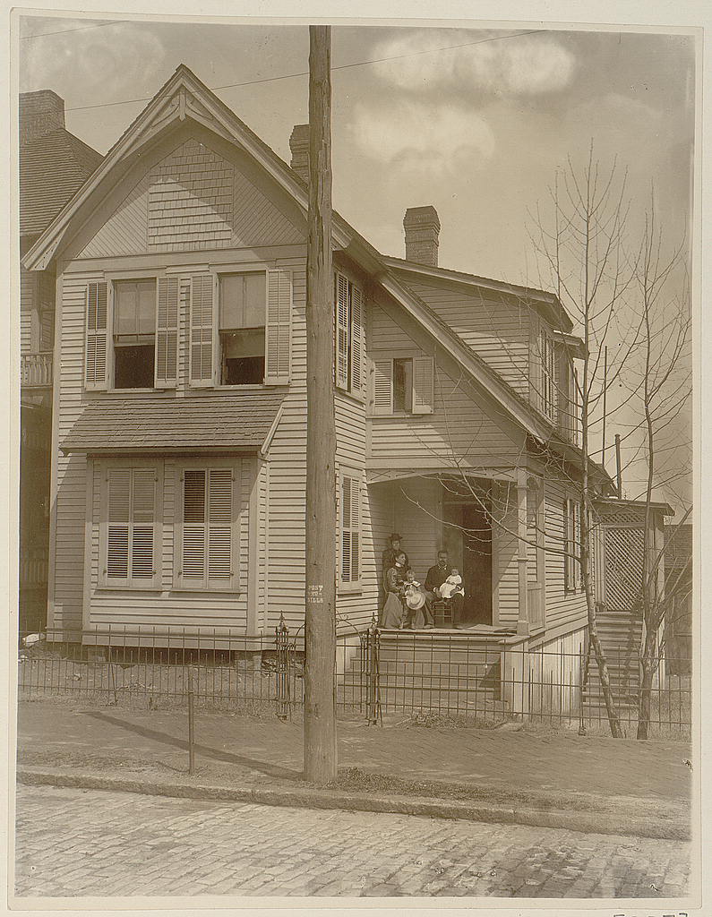
| Photograph or aerial image | Visible buildings, street form, public presence, transportation | Image alone does not prove ownership, medical function, trust, or later displacement |
The National Archives has supported projects that reconstruct Black neighborhoods through maps and records and trace displaced families and institutions. That method is useful because it treats disappearance as a research problem rather than an invitation to guess. It also requires privacy discipline: a public map or directory can support public history, while a private relocation or patient file may contain information that must remain protected.
Reconnection is not the same as restoration
Current federal Reconnecting Communities programs explicitly recognize that past transportation decisions can block access to health care, education, food, jobs, nature, and worship. That recognition matters. It does not establish that every proposed cap, boulevard, bridge, park, or street connection will restore the institutions and relationships that were lost.
A care-centered repair plan needs more than concrete. It may require anti-displacement protections, affordable commercial space, support for Black-owned and Black-serving providers, safe walking and transit, archive recovery, resident and descendant governance, and measurements of whether people can actually reach services. A physical reconnection can improve movement while leaving ownership, cost, trust, and continuity unresolved.
What this article does not do
This article does not diagnose a neighborhood or attribute an individual illness, death, trauma response, or missed appointment to urban renewal. It does not tell a reader which current hospital, clinic, pharmacy, transit provider, neighborhood, or redevelopment project to use. It does not provide medical, legal, relocation, property, planning, benefits, or emergency advice.
It does not publish private patient records, medical files, family addresses, relocation case files, compensation records, insurance records, genetic information, or unpublished family evidence. It does not identify unnamed people in archival photographs or convert a streetscape into proof of ownership, care quality, or displacement.
Its purpose is narrower and stronger: to make the public record of Black care infrastructure visible, to distinguish institutional outcomes, and to show readers how renewal and highway records can be read alongside health, business, church, education, transit, and archive records.